Mior
Excursion map
Skånebilder
Northwest Skåne
Utväilnge - Jonstorp
Photo album
Slideshow
Pictures:
23 August 2013
Sandön
Path
Reed
Jetty
Sea
Path
Cows
Pasture
Rönnen
Forest path
Harbour
Path
Pebbles beach
Farhalt
Gate
Under trees
Small bridge
Cows
Trail markings
Görslöv bridge
On bridge
Vuojatädno
Sheep on a row
Tracks
In love
Read more>>
Naturguiden
Skånetrafiken
 Utväilnge - Jonstorp
a hike along the coast, through cow and sheep pastures, past the bird sanctuary Rönnen, suspension bridge over Görslövsån.
23 August: Utvälinge - Jonstorp, 11 km
Utvälinge, Skeppsvägen, where we go off bus 225. Going down to the
former brickworks. Last time I was here, you could go into. Today the gate is
locked. We walked
Vegeåleden, trail along Vege å from
Strövelstorp to Utvälinge. From here you can then go through
Kronoskogen
to Ängelholm.
But where to start Kullaleden? We are probably on the wrong side of the
brickworks. Walk a gravel road in Utvälinge, turn off towards the footbridge
out to Sandön. Out there are bathing and rich birdlife. On the bridge,
which I understand is only in place during the summer, a group of children who
nets in the water. We do not go over, but continue on the gravel road through
the community. The trail leads onto a path at the reed belt of the sea. Trail
marks are on poles, on some stands signs to bus stops and coffee
symbols. Coffee symbol is found in Norra Häljaröd and pointing to
Albertsgården up at the old road. We go there, it's lunchtime and we have
ordered some sandwiches to avoid having to carry food. Read more on my site
about
Albertsgården.
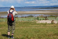
The walk continues on the path along the reedbed to the sea. Soft surface to
walk on. Coming up to a stile to pastures at Rönnen. Rönnen is a
bird sanctuary with access forbidden entire year. Many geese out there. What I
can see through my small binoculars is is most barnacle geese. The cows
ruminate placidly, and let us not interfere. It's like walking on a lawn. We
leave the pasture via a stile. On the trail through a grove of trees until
Häljaröds port. Here are beautiful houses, some of them with stunning
sea views.
Coming to a gate to the pasture, the trail rounds the pasture on a dirt road
past a luxury home with natural garden. Onto a gravel path through "Jungle
Forest," as it says on a sign. Inside the forest, are pebble field, perhaps
from the time when the country was lower after the ice age weight?
Before Farhult bath, the path is on those pebbles, past a small marina, until
the grass-covered dunes at the bath. The beach is almost empty. Kullaberg is
visible at the horizon in the west. In Farhult we have a short break at the
cafe Solvik which, however, is closed. Walking through the village, turns into
a lawn, the path goes along the paddocks. A pasture is passed through the
gates, and in at is something that has been a shooting range with a shed. At
the shed is a picnic table. Where the trail curves into the path along the
pasture is on the map a shelter. Do no see any, see no reference. Or is it the
little house that stands there, does not look like that, or are we searching
bad. (It's the shed at the shooting range that has been renovated for overnight
stay.)
Between the gates of a two-meter wide cow path is trodden ground of hooves and
can probably be muddy when wet. The trail continues beyond the fence under
tree branches. A bridge over a stream, then the gate into the pasture. Cows
and frisky bull calves meets us at the next crossing with gates. We follow
slavishly trailmarkings on the fence, even if one can cross the pasture, to
the gate out of the pasture. Then walk between reeds and fencing, a gate that
takes us to the bridge over Görslövsån. A beautiful suspension
bridge. On the stairs up is a maximum of 5 persons 450 kg, the bridge stands
up to 5 persons 400 kg. What about weight? The bridge is secured in large
concrete foundation. For safety's sake, we go over individually. We remember
long bridges in the mountains. The most impressive I've seen is the bridge is
over Vuojatädno on Padjelantaleden.
A gate takes us into a pasture again, where cows and sheep coexist. A flock of
sheep walking on the line over the field. The trail follows the sheep and cow
tracks towards Jonstorp. When we arrive at Jonstorp raise a flock of geese
over the water and circle around before landing again. A kind of greeting? On
the way to Jonstorp becomes a grasshopper/biter(?) in love with me. I must
reject courtship. In Jonstorp we take the bus to Höganäs for
transportation home.
Map
